CALMIT Research Facilities Research Platforms
Airborne Platform
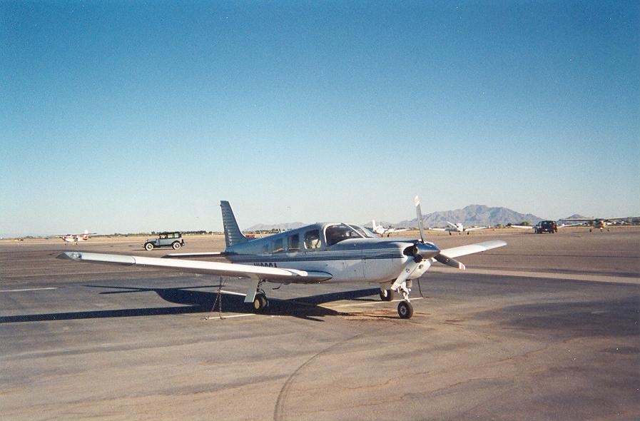
CALMIT operates a Piper Saratoga aircraft for airborne remote sensing data collection. The platform currently supports an imaging spectrometer (AISA-Kestrel), an imaging fluorometer (AISA-IBIS), and a thermal imager (Jenoptik Infrared Camera).
The CALMIT airborne research program, with its particular combination of hyperspectral, thermal, and chlorophyll fluorescence imaging systems provides a unique ability to detect subtle aspects of plant health and function (e.g. early stress detection). While the primary focus is research, the CALMIT airplane and airborne instruments are also available as a service on a cost basis. The CALMIT airplane is also available as a test facility for airborne instrument trials.
"Hercules" Terrestrial Platform
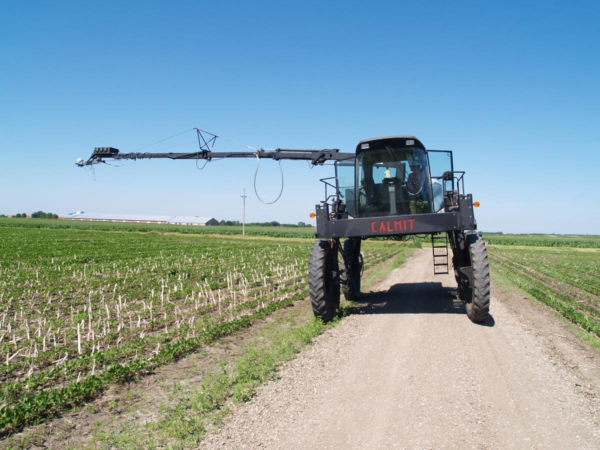
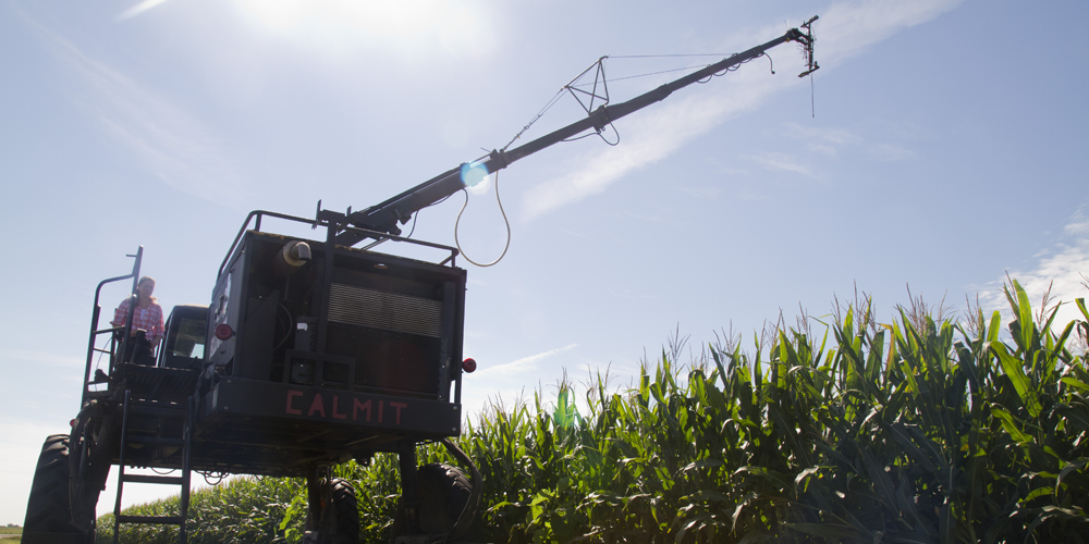
CALMIT operates a unique, versatile all-terrain instrument platform (“Hercules”) for collecting spectral data in agricultural fields. Hercules provides a high-clearance vehicle for measuring plant optical and thermal properties in field settings. The instrument package can be raised to a height of approximately 50 feet above the ground surface and rotated through a full circle around the platform. The maximum sensor payload for the boom, at full extension, is ~60 pounds. The operator has complete control of the sensor position from the deck.
Aquatic Platform
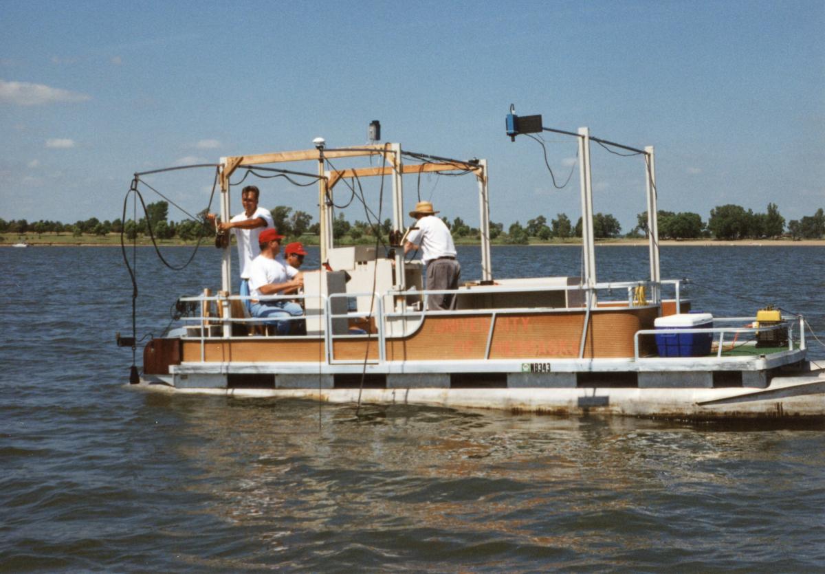
CALMIT operates a 24-foot pontoon boat, which has been specially modified for collection of spectral data above, at, and beneath the surface. The boat provides an excellent workspace for data collection on lakes and reservoirs.
In addition to equipment for monitoring radiation fluxes, the boat carries a GPS receiver, onboard computing, and portable water-quality and analysis equipment. Researchers often operate our numerous pyranometer, terrestrial-quantum, and underwater-quantum sensors when collecting spectroradiometer data in the field.
In the case of the underwater sensors, upwelling and downwelling PAR are typically measured at two different depths, as a means of calculating the rate of extinction of light in lakes and reservoirs. The boat can be safely towed over long distances to facilitate study of distant aquatic systems. Water samples are typically collected and analyzed in support of our remote-sensing research on lakes and reservoirs.
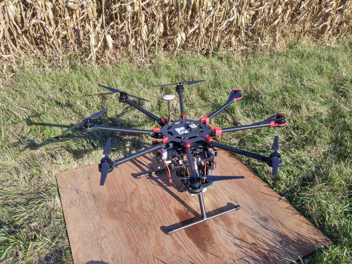
UAV Platform
Preceding Data Collection Platforms
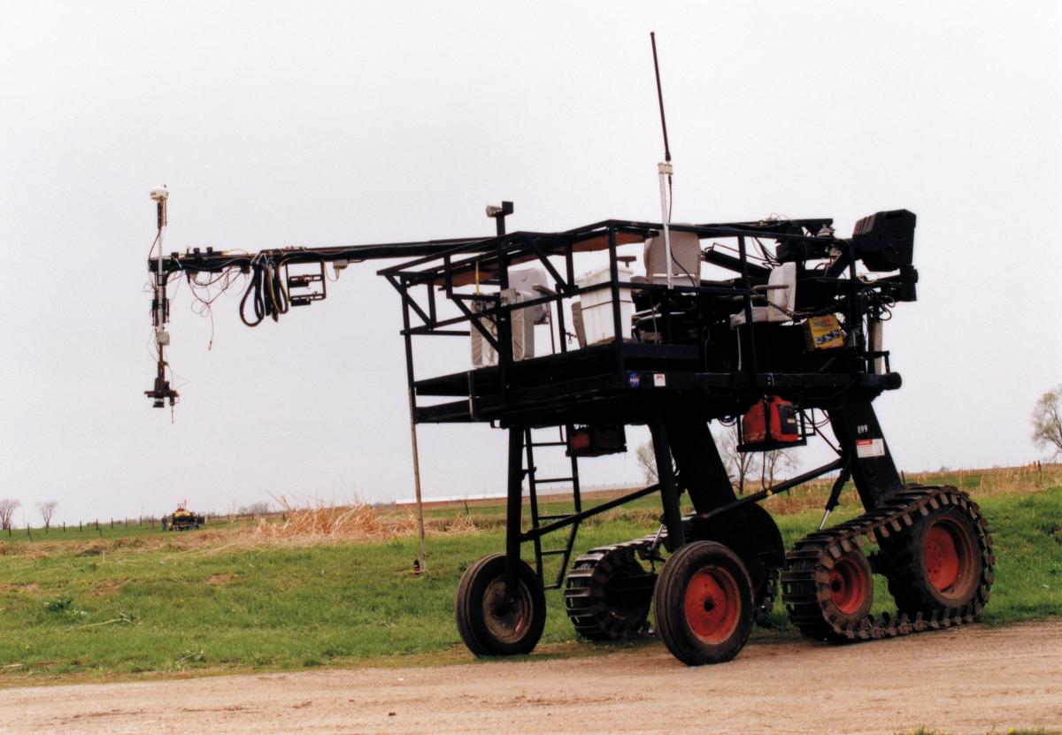
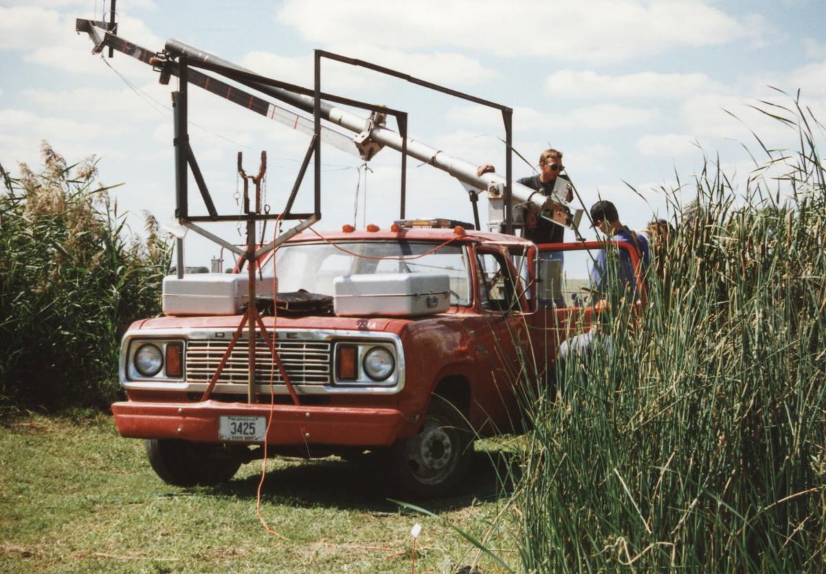
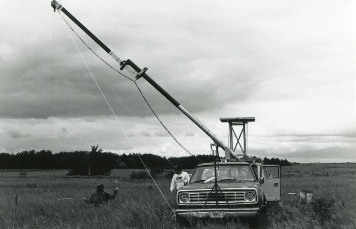
Goliath was the precursor to CALMIT's current all-terrain platform, Hercules. Goliath allowed sensors to remain in the principal plane of the sun and were mounted at a distance from the vehicle to minimize interference.