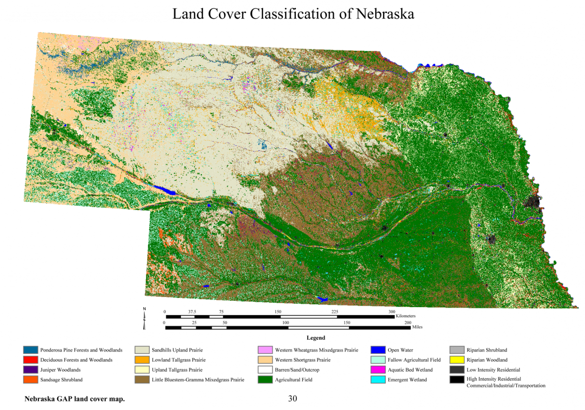
 Figure 1. Detailed land cover map of Nebraska prepared for the Nebraska GAP project.
Background: A Gap Analysis consists of mapping three data layers — land cover, predicted distributions of vertebrate species, and a stewardship layer depicting both location and conservation status of protected areas. This data is then assessed to determine how much of a target species’ (plant or animal) habitat is in conserved areas. From this assessment, planning decisions can be made about whether further protection is merited.
Project Goal: The effort seeks to identify the degree to which all native plant and animal species and natural communities are or are not represented in our present-day mix of conservation lands. Species-rich areas, vertebrate species and land cover types that are not adequately managed for the long-term maintenance of native species and natural ecosystems constitute conservation "gaps."
Objectives:
- map existing statewide vegetation and other land cover;
- predict the present distributions of native animal species;
- determine the extent and importance of places of native species richness;
- compare the distributions of vegetation communities with existing land management goals;
- compare places of species richness with existing land management goals;
- provide an objective basis for a statewide biodiversity management strategy.
Funding for this project was provided through
- USGS/Biological Resources Division - Gap Analysis Program
- Institute of Agriculture and Natural Resources - Conservation and Survey Division
- US Fish and Wildlife Service
- U.S. Environmental Protection Agency, Region VII
