2005 Statewide Land Use Mapping in Nebraska
| Data | File Size | Metadata | Download Data* |
|
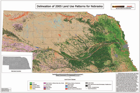
2005 Nebraska Land Use
|
|||
| ESRI GRID and Legend File |
22.9 MB
|
||
| GeoTiff Format |
25.2 MB
|
||
| ERDAS Imagine Format |
21.0 MB
|
||
| 2005 Land Use Map in .PDF Format |
18.9 MB
|
-
|
|
|
Irrigation Data
|
|||
| 2005 Center Pivots (ESRI Shapefile) | 39.8 MB | View | |
| 2005 Other Irrigation (Non-Pivot) (Shapefile) | 31.8 MB | View | |
| Final Report | |||
| 2005 Land Use Mapping for the State of Nebraska Department of Natural Resources (.PDF) |
5.1 MB
|
-
|
