Quick Drought Response Index (QuickDRI)
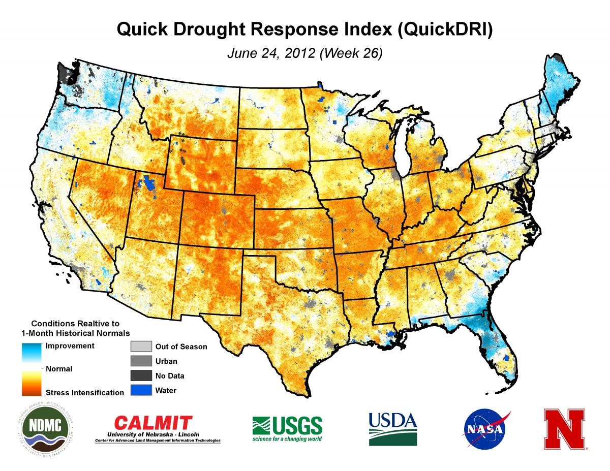
Image: 1-km QuickDRI map showing the intense short-term drought conditions across much of the United States as the severe to extreme 2012 drought event emerged.
QuickDRI is a short-term composite drought index that integrates satellite observations of vegetation health, evapotranspiration, and soil moisture with precipitation-based drought indices and other environmental landscape descriptors (e.g., land use/land cover, soils and elevation) to detect short-term and rapidly changing drought conditions. This research was supported by NASA’s Applied Water Resources Program and a 1-km resolution, gridded QuickDRI product will be operationally produced over the continental U.S. starting in the summer 2017.
Center Faculty: Wardlow
Collaborators:
